Picking up my backpacking trip to the Grand Canyon: I hiked down the South Kaibab trail in one day and camped by the river at Bright Angel Campground. Now I have to hike back up the 4340 feet and 9.5 miles to the rim on Bright Angel trail.
It rained hard overnight while I was camped at Bright Angel. The rain and wind woke me several times in the night, but I’m happy to report that my tent stood up to them both without leaking. When nature called in the wee hours of the morning, I was glad to have a waterproof shell close at hand, though my camp site was relatively close to the toilets. Side note: there’s an astonishing amount of infrastructure at the bottom of the Grand Canyon, including the unimaginable luxury of flush toilets!
I was extremely lucky: the rain let up just before dawn and by the time I had repacked my sleeping bag and stowed everything back in dry sacks, the clouds were breaking up into a sunny morning. My tent was wet on the outside but I managed to roll it cleverly so that the dry inside stayed dry.
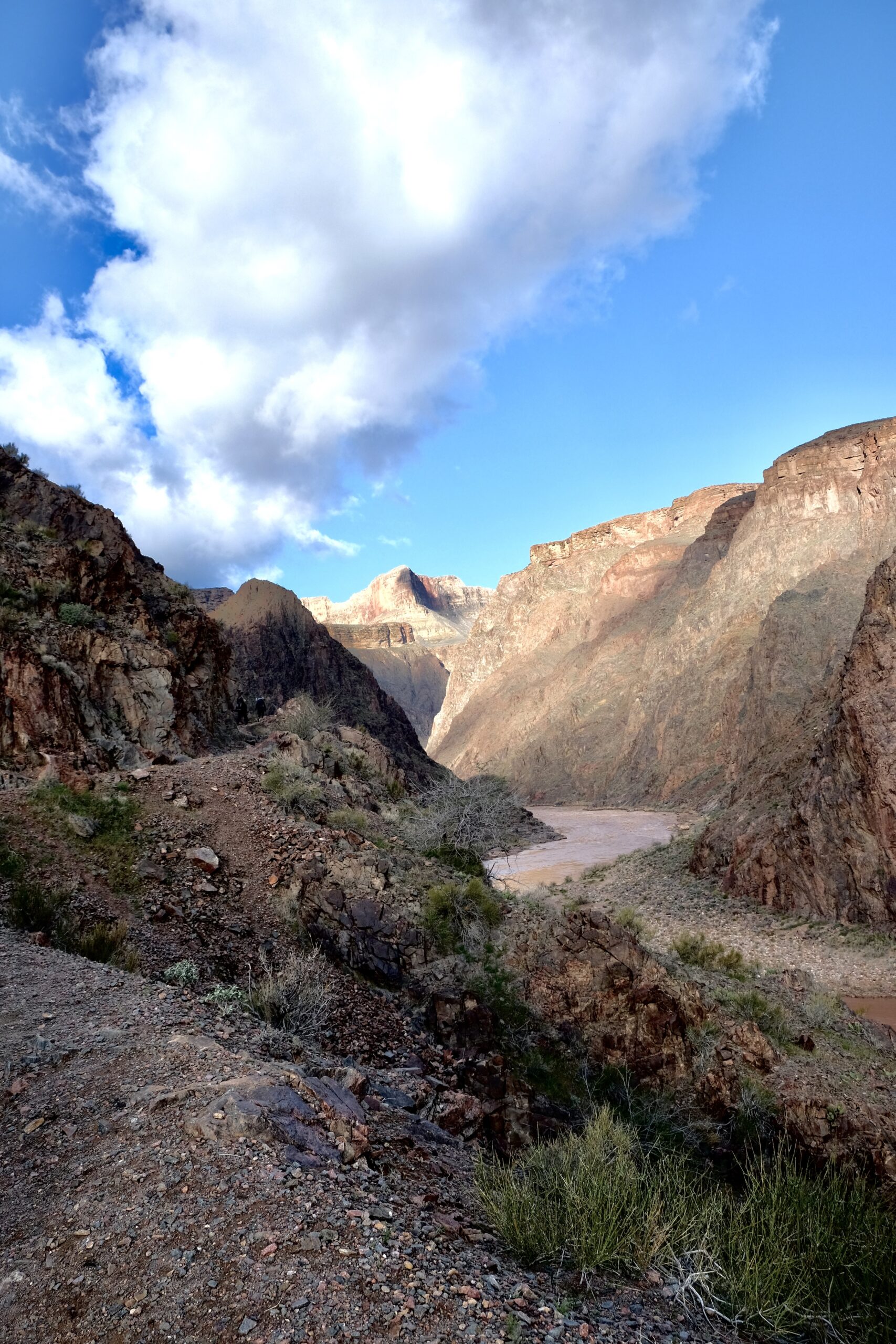
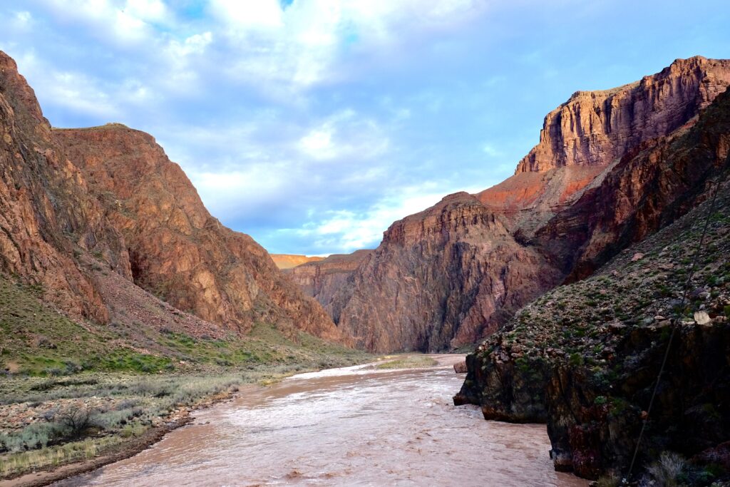
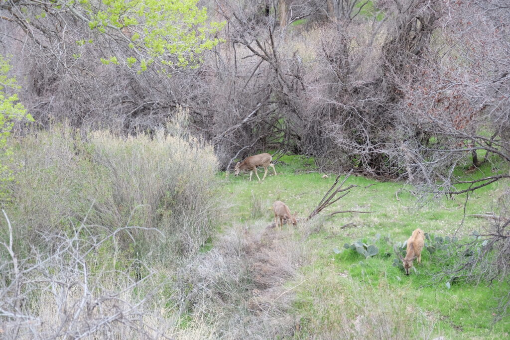
It was a lovely morning! I saw deer browsing by the river on my way to the silver bridge to cross back to the south side and carry on up the Bright Angel trail. This is the view to the west as I crossed the silver bridge
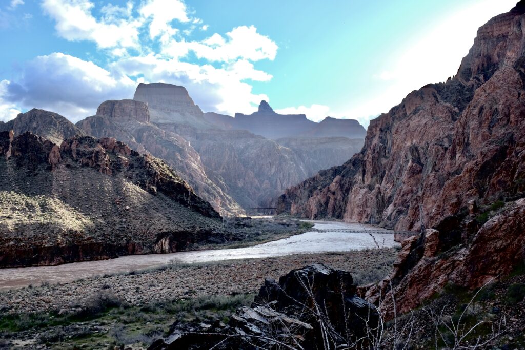
And this is the view to the East, looking back toward the silver and black bridges.
This is right about the time I realized my I hadn’t sent my morning check in to my emergency contact back east. And then I realized I did’t know where my inReach (satellite communication device) was. I knew I had it the previous night when I sent my evening check in, and I knew I brought it into my tent overnight to keep it out of the rain. Had I put it in the pocket of my soft shell or my rain shell? Had I stowed it with my other electronics? Step 1: empty everything out of my pack there by the trailside and look in all the places I thought it might be. Step 2: look in all the places I really didn’t think it would be. Step 3: hike back to my camp site to make sure I hadn’t left it on the big rock or in the food safe. I hadn’t. Step 4: Realize that the only place I hadn’t looked was in my artfully rolled up tent body, and I should have done that before hiking back to the camp site… because there it was. My lesson from that experience is to add a specific step to my mental checklist for packing up in the morning to make sure I have my inReach well, within reach. I just added ~2 miles to my to my day– fortunately they were mostly flat along the river.
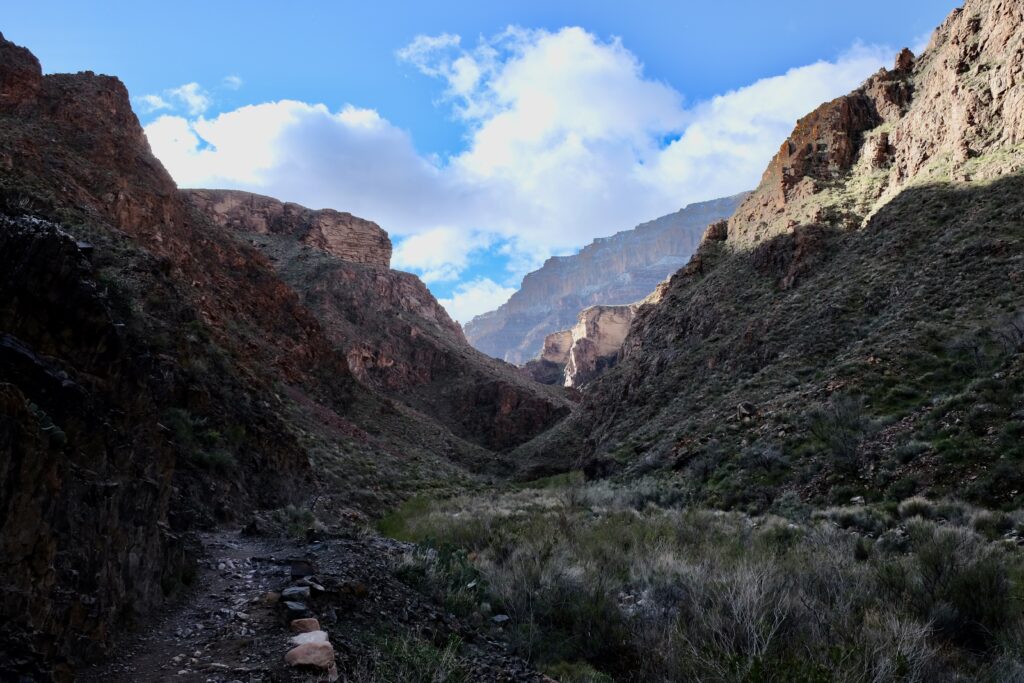
While the South Kaibab trail follows Cedar Ridge and is mostly exposed, the Bright Angel trail follows Garden Creek and Pipe Creek and it’s mostly tucked away in the drainage. It seems to me a little backwards that the trail named Bright Angel is on the opposite side of the river from the creek that John Wesley Powell named Bright Angel. North Kaibab trail follows Bright Angel creek, and Bright Angel Trail follows Garden Creek. It helps that both creeks, on opposite sides of the river, follow the Bright Angel Fault, one of several faults running perpendicular to the river that were created about 750 million years ago when Australia and Antarctica broke away from North America, breaking up the supercontinent of Rodinia1.
The trail begins to climb away from the creek and enters a series of switchbacks known as the Devil’s Corkscrew,
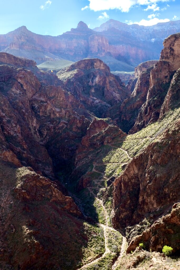
At the top of the Devil’s Corkscrew you cross the Great Unconformity again, where 525 million year old Tapeats Sandstone sits atop 1700 million year old Zoroaster granite.
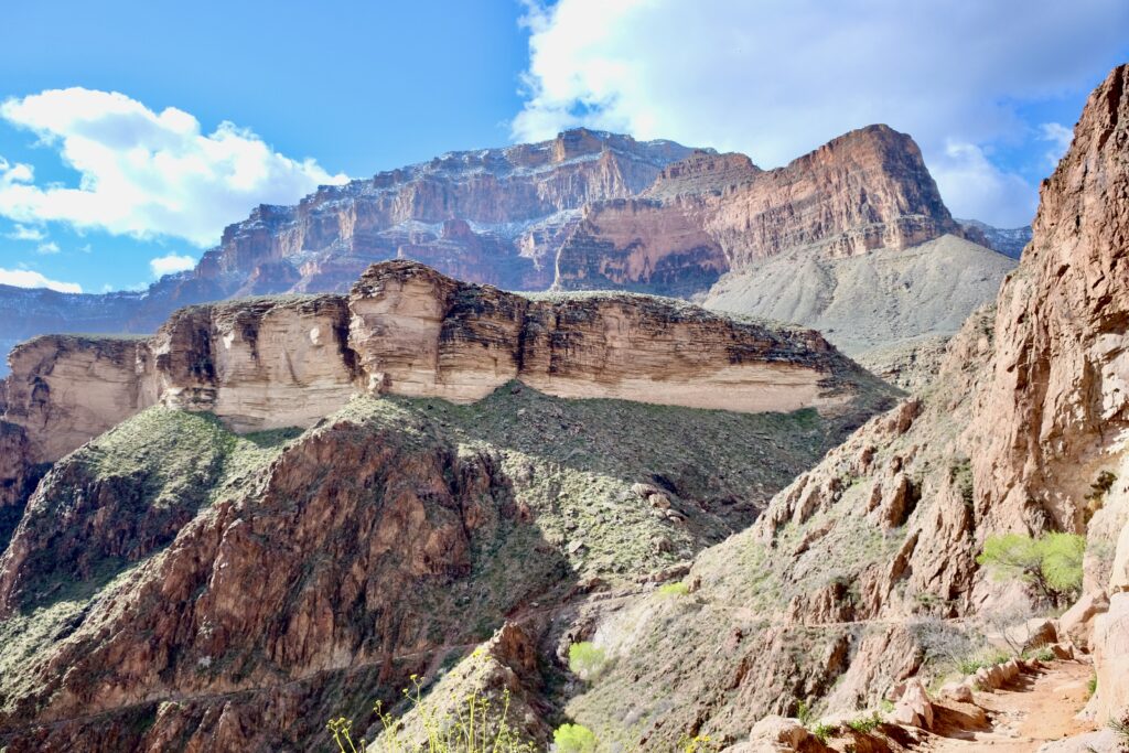
The sandstone is soft compared to granite, and Garden Creek has cut deeply into the rock, creating the Tapeats Narrows
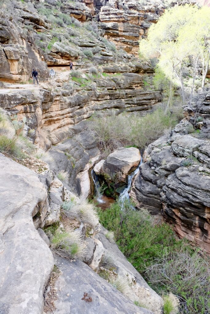
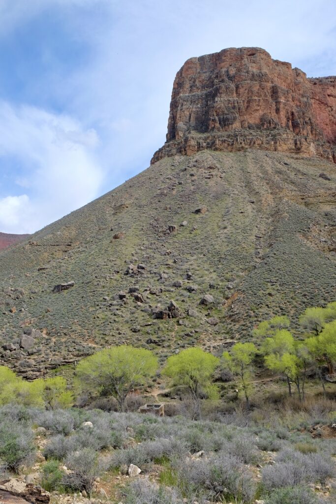
Above the narrows, the trail continues to rise until it reaches the Tonto Platform, and the lush oasis of Havasupai Garden, where a spring emerges from the fault1, sustaining a small pocket of cottonwood trees, lush grasses, and rodents of unusual size (a.k.a. mule deer).
I reached my campsite at Havasupai Garden late morning. It was only 5 miles from Bright Angel campground, but my trip back to look for my inReach made it more like 7. Total elevation gained only about 1300 feet. That leaves 3040 left to go. Tomorrow.
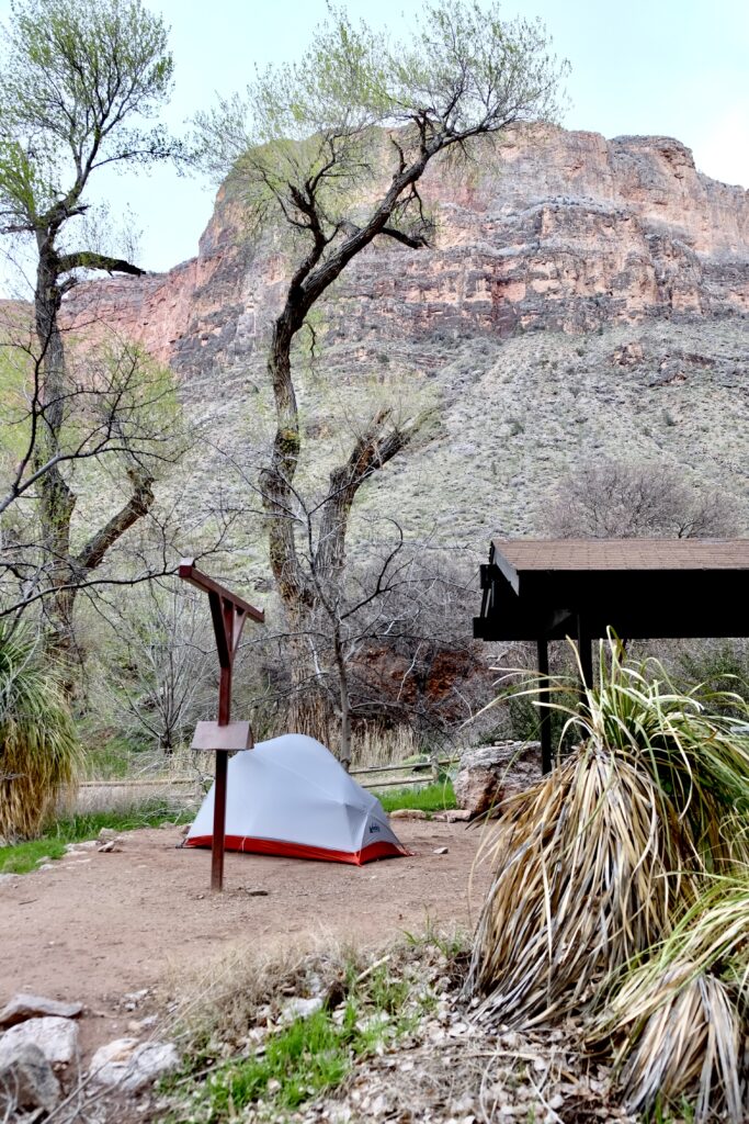
As I approached the campsite, clouds were beginning to roll in and shortly after I set up my tent, it started to hail. Then rain. Then hail a little more. It was cold and windy and there were various kinds of water falling from the sky, so I retreated to my tent for a nap. When the squalls passed over in the afternoon, I ventured out along the Plateau Trail to the end of Plateau point, which deserves its own post (coming soon).
1 Lon Abbot and Terri Cook “Hiking the Grand Canyon’s Geology” the Mountaineers Books 2004