This was my third attempt to see the Grand Canyon, and I’m delighted to report that I was successful, and it absolutely lived up to its name!
One of the most important things I learned in graduate school is that I don’t love 110 degree heat, so when I started thinking about a backpacking trip to the Grand Canyon, I knew Summer was the wrong season. Even though the North Rim is still closed in early Spring, and there was snow on the South Rim and down some part of the trails, it was a lovely time to spend a few days hiking down to the river and back up again!
I didn’t book permits in advance, but took my chances with getting last minute walk-in permits from the backcountry office. By whatever combination of luck and planning (it was a weekday, and still early in the season), I had no trouble scoring permits to camp at the Bright Angel campground by the river the first night and at Havasupai Gardens campground halfway back up the following night. The shuttle bus took me from the backcountry office to the South Kaibab trailhead, and I set off around 9:30 in the morning.
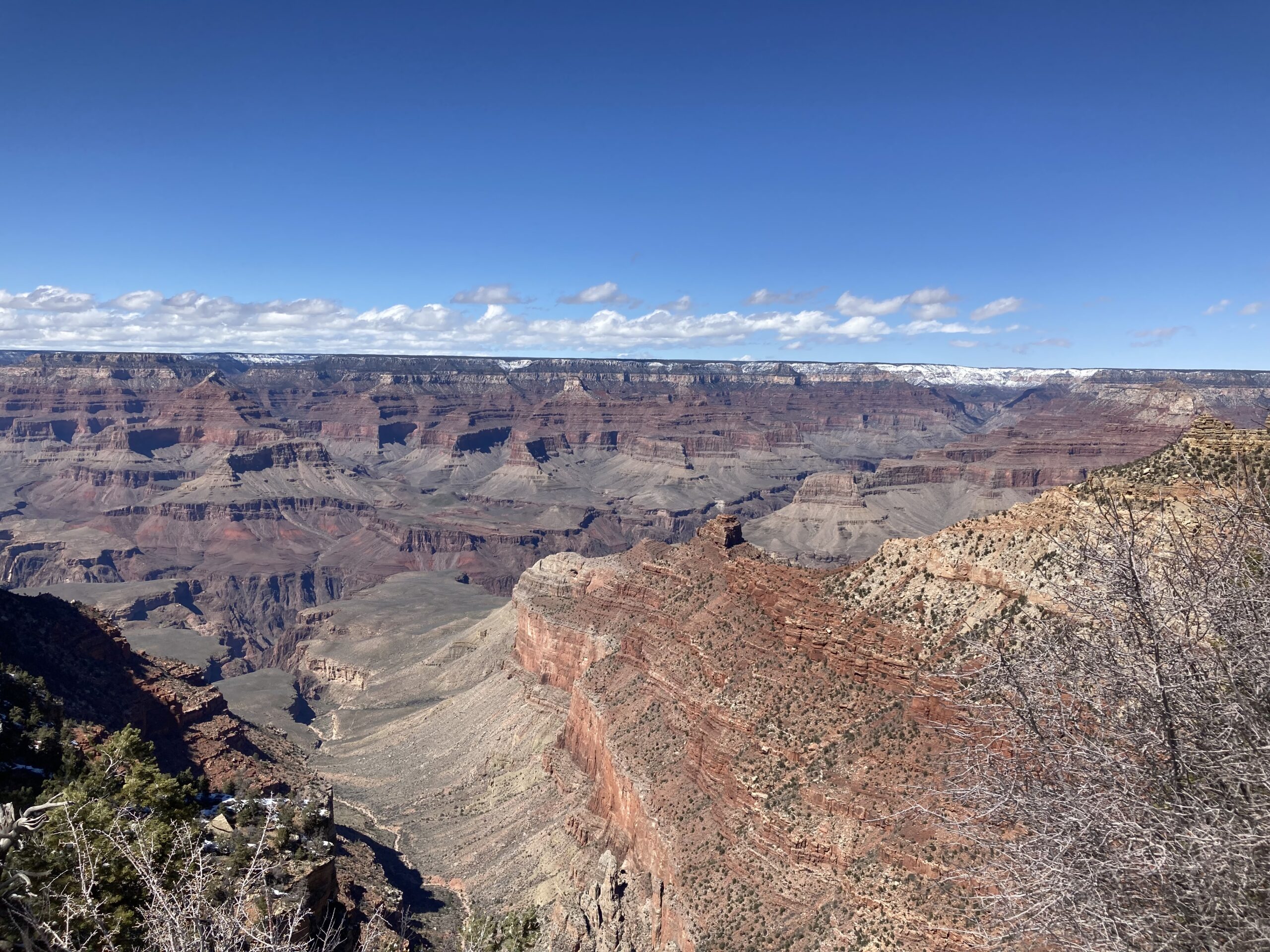
The South Kaibab trailhead is at 7200 feet, and follows Cedar Ridge down 7 miles and 4700 feet to the river.
The packed snow and ice at the top of the trail and powdered at the top of the cliffs soon gave way to exposed rock as I began my hike backwards in time through 1.84 billion years of planet Earth’s geologic history.
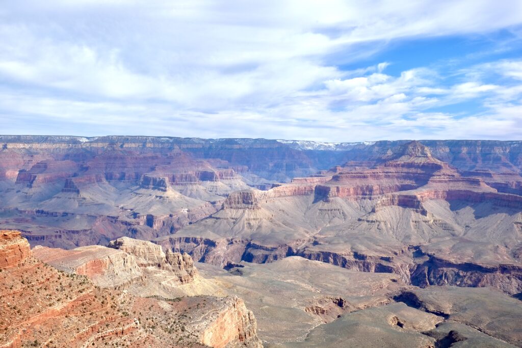
Step by step the eroded cliffs and towers that once I looked down now towered over me as the capping limestone gave way to sandstone and the elegant cross bedding of ancient deserts.
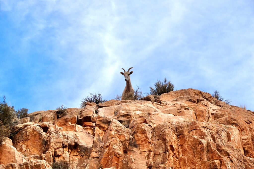
I was a little over three miles down the rim when this bighorn sheep decided to check me out from her vantage point atop a butte. As she was looking down on me and I was looking up at her, a pair of California Condors soared overhead not much higher than where the bighorn was standing. Condors may have a face only a mother could love but they are absolutely magnificent on the wing, and I feel very lucky to have seen them in two different national parks– here and in Zion in 2018.
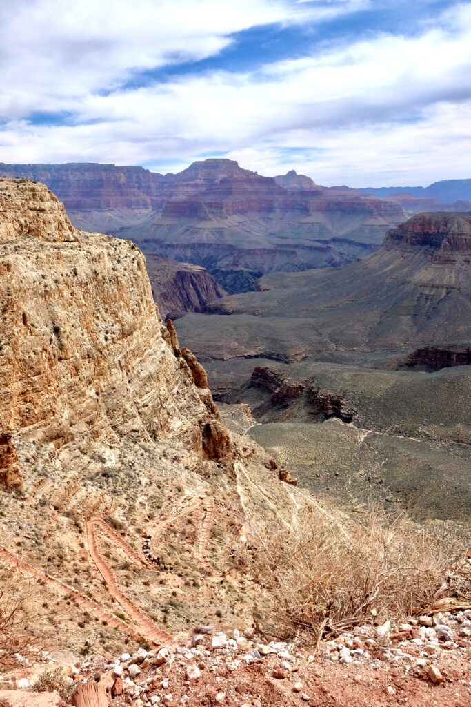
My wildlife encounters were at the start of a series of steep switchbacks down a massive wall of redwall limestone. About halfway down the switchbacks I met a train of pack mules coming up. It’s been a wet winter in Arizona, and all the vegetation on the slopes and plateaus was surprisingly green.
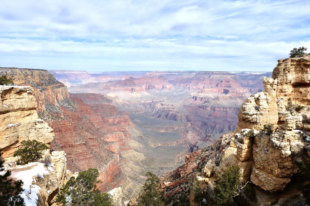
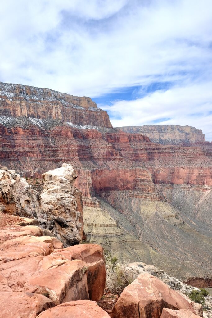
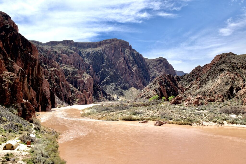
It wasn’t until below the switchbacks and past The Tipoff (4.5 miles and 3280 feet below the rim) that I got my first glimpse of the river. My destination, the Bright Angel campground, is the patch of bright green in the side canyon far below.
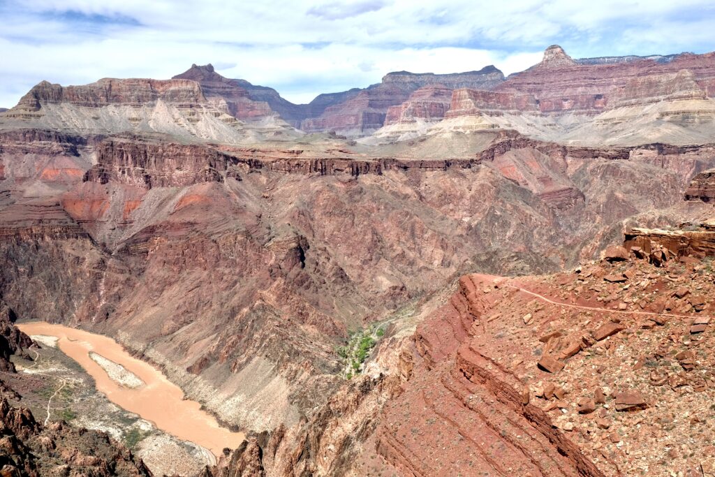
While I took this photo as a my first glimpse of the river, it also captures some very cool geology. Here the trail crosses sandstones and mudstones of the Tapeatz group, laid down in the Paleozoic Era about 525 million years ago when this piece of the planet was lapped by the precursor of the Pacific Ocean1. Below it, the dark greenish rock (Vishnu schist) marbled with paler veins (Zoroaster granite) is some of the oldest on the surface of the Earth, formed about 1700 million years ago when a protocontinent called Wyomingland collided with a volcanic archipelago called the Yavapai Arc at a subduction zone1.
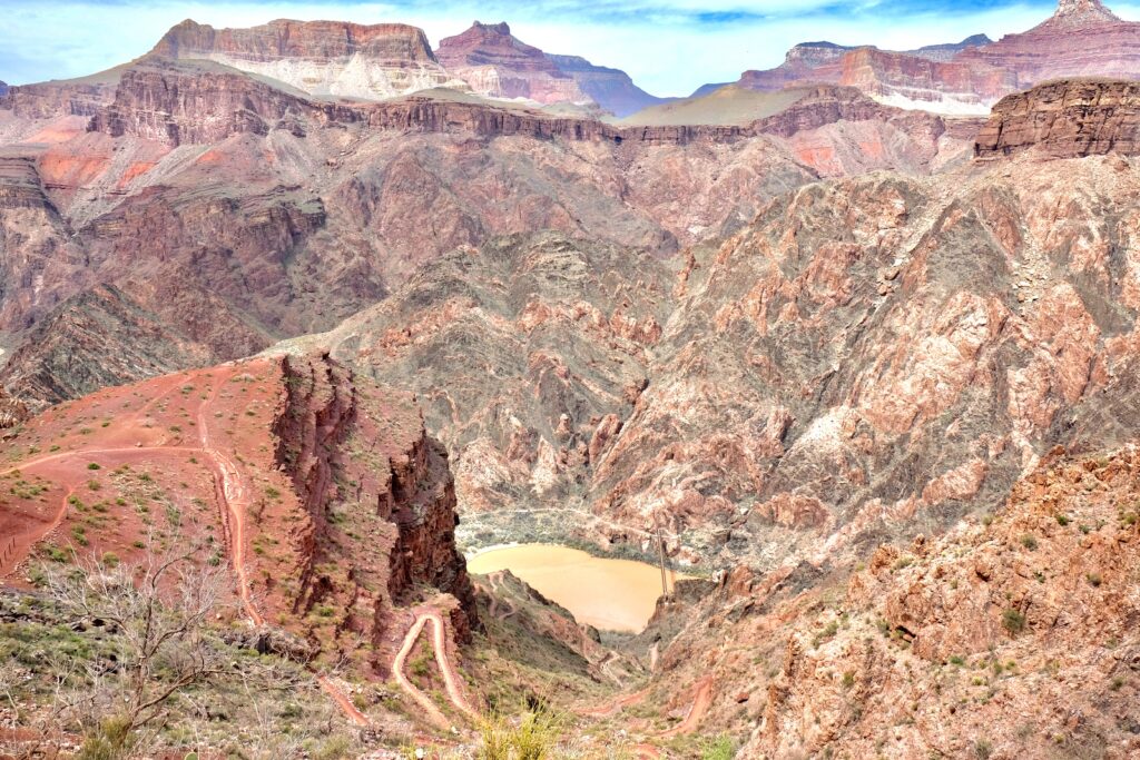
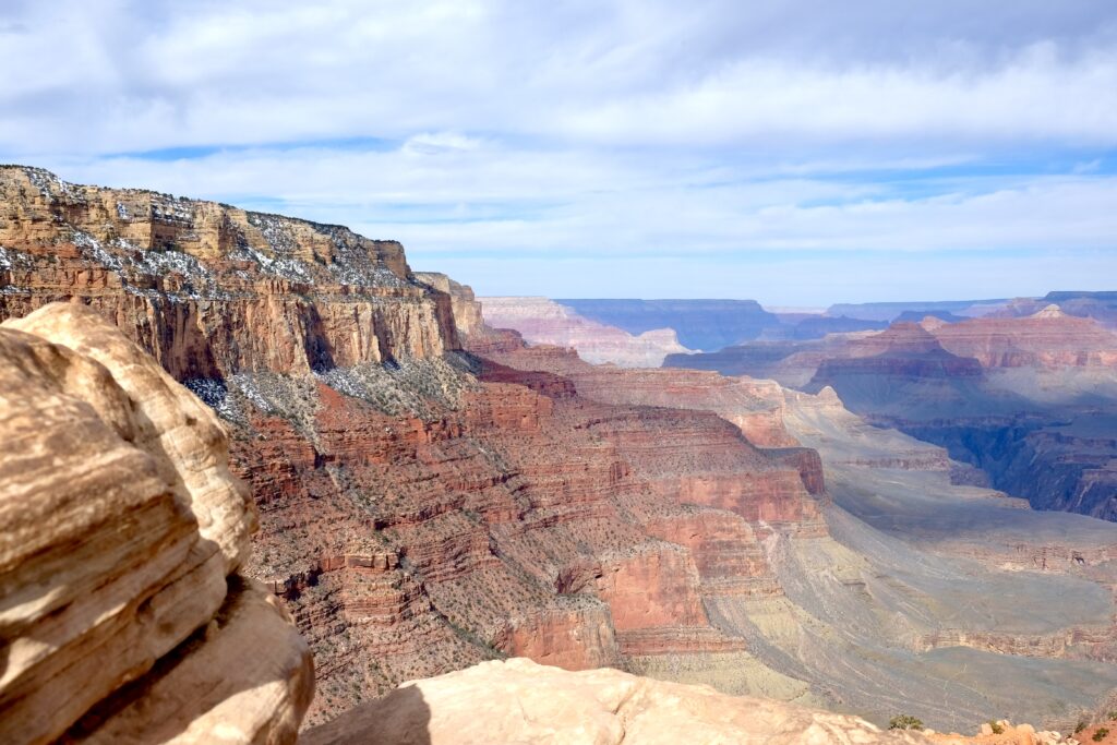
In the 1200 million years that separate these two layers, other rocks were deposited and eroded away completely except where they were protected by pockets or folds created by faults. Here the trail switchbacks down through one of the faults that protected the “Grand Canyon Supergroup“, and crosses the “great unconformity“– the 1200 million years of missing geologic history1.
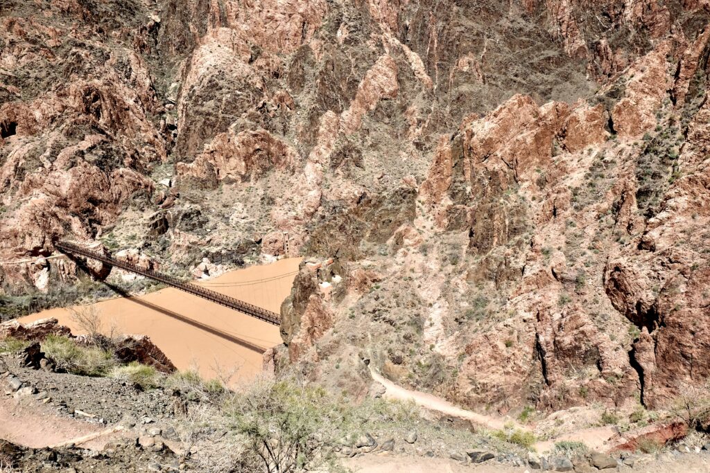
Even though intellectually I knew it was there, the suspension bridge built into the living rock of the Grand Canyon surprised me. Before the Black Bridge was built in 1928, the only way to cross the Colorado was in a metal cage suspended from a cable. During construction, most of the materials were carried from the train depot by mule, but each of the 1-ton cables was carried down the trail by people from the Havasupai tribe, walking the 9 miles single file with the cable draped over their shoulders.
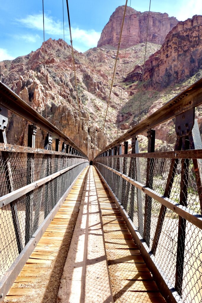
Everybody takes these pictures: the view of the bridge from the mouth of the tunnel on the south side of the river, and the view from the bridge West toward Bright Angel campground.
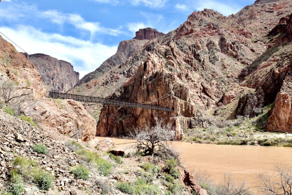
I’m a little fixated on the bridge– it looks so incongruous connecting two piles of barren rock across the river. Small wonder it was dedicated in 2019 as a National Civil Engineering Historic Landmark.
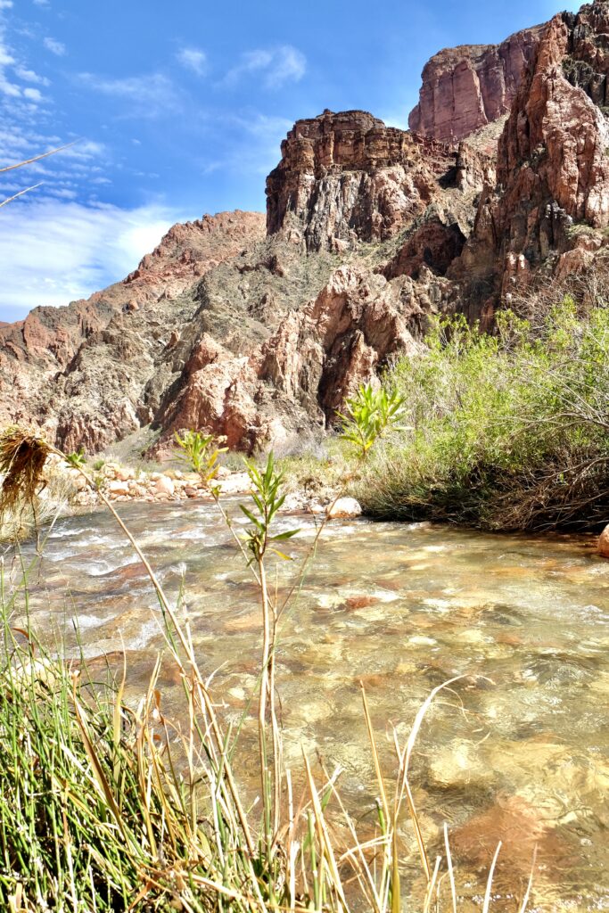
Bright Angel Creek, which flows down from the North Rim, certainly lives up to its name! I reached the campground in early afternoon, and after setting up my tent, I soaked my feet for a while in Bright Angel creek before waking a little ways up North Kaibab trail.
By the time I got back to my campsite, clouds had closed in overhead and the wind was picking up. I had to tuck my stove in between rocks protect it from wind to boil water for dinner, and overnight it rained hard. I’m delighted to report that my tent stood up to both wind and rain, and even more delighted that the rain stopped around dawn and the skies cleared for as I packed up and started hiking the next morning. But that’s the next post.
1 Lon Abbot and Terri Cook “Hiking the Grand Canyon’s Geology” the Mountaineers Books 2004